Scotland Prepares for the Brunt of Storm Dave Amid High‑Wind and Snow Alerts
Power provider SSEN forecasts gusts up to 80 mph across the Western Isles and Skye as Storm Dave approaches, prompting widespread warnings and travel advisories for the Easter weekend.
Scotland Braces for the Worst of Storm Dave with Wind and Snow Warnings in Place
Storm Dave is set to unleash a combination of forceful winds and snowfall across Scotland during the Easter weekend, prompting authorities to issue a series of precautionary alerts.
Visual Overview
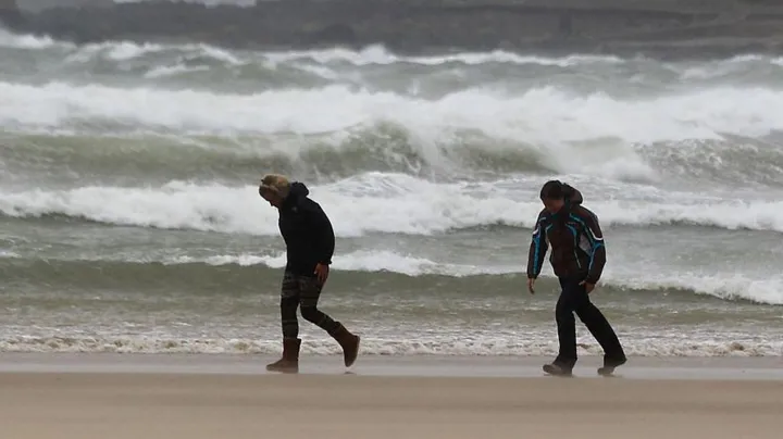
Geographic Scope of the Wind Warnings
Three distinct yellow wind warnings have been disseminated across Scotland, covering the western Highlands, Argyll, the Western Isles, and the island of Skye. Each warning is intended to alert residents and travellers to the heightened risk of gusts that may approach, or in isolated locations, exceed, 80 mph.
Power firm SSEN predicts that wind gusts could reach about 80 mph in parts of the Western Isles and Skye, while the high‑wind envelope is also projected to affect Orkney and Shetland on Sunday.
Timeline of the Issued Alerts
A Met Office yellow warning for wind is in force from 18:00 on Saturday until midday on Sunday for many parts of Scotland. A separate Met Office wind warning that specifically covers southern Scotland runs from 17:00 on Saturday to 07:00 on Sunday. In the northern archipelagos, Orkney and Shetland have a warning extending until 15:00 on Sunday, with peak gusts of 60‑70 mph forecast and a “slight chance” of gusts reaching 85 mph in exposed locations.
Met Office Commentary on the Storm’s Evolution
A Met Office spokesperson explained that a rapidly deepening area of low pressure, identified as Storm Dave, is expected to move north‑eastwards close to, or across, north‑western parts of the United Kingdom during Saturday evening and night, before clearing into the North Sea by Sunday.
According to the Met Office spokesperson, “Peak gusts of 50‑60 mph will be possible fairly widely, with 60‑70 mph in more exposed locations.” The spokesperson added that “Large waves may lead to some dangerous conditions around windward coasts.”
Transport Implications and Advisory Notices
Royal Society for the Prevention of Accidents (Rospa) warned that the combination of high winds and possible snowfall is likely to affect both public transport and road travel. Royal Society for the Prevention of Accidents (Rospa) advises anyone travelling to take extra care, allow additional time, and consider postponing journeys where possible.
Police Scotland has urged the public to delay journeys if they can. Ch Supt Scott McCarren, head of road policing, emphasised that “Stopping distances can be at least double on wet roads compared to dry conditions, and spray can reduce driver visibility.” He further cautioned that “HGV and bus drivers should drive with extreme caution and be aware you may be asked to park at a suitable position by the police.” Ch Supt Scott McCarren, head of road policing, concluded with a reminder that “If you need to travel, please drive to the conditions and take extra time for your journey.”
ScotRail has instructed passengers to monitor its social‑media channels and the journey‑check website for real‑time updates on service alterations.
West‑coast ferry operator CalMac has already warned of possible disruption to its sailings, while Highlands and Islands Airports Ltd (Hial) has indicated that adverse weather could have an impact on scheduled flights.
Snowfall Forecast and Associated Hazards
In addition to the wind threat, the hills across central Scotland and the north‑west are expected to receive sleet and snow during the weekend. A yellow weather warning for snow has been issued for the period from 15:00 on Saturday to 03:00 on Sunday.
A Met Office spokesperson described the expected conditions, stating: “During the evening snow may turn heavier and as winds increase, blizzard conditions with drifting and blowing snow likely to lead to very poor visibility across the hills and mountains of the north‑west of Scotland.”
Forecasters noted that accumulating snow on roads is most likely to occur in areas above 656 ft (200 m) where up to 4 in (10 cm) of snow is possible, with a small chance of up to 8 in (20 cm) in the most exposed locations.
Overall Outlook and Expected Clearance
By late Sunday, the most severe elements of the storm are expected to have moved away, allowing conditions to improve and the majority of disruption to subside.
The public is urged to stay updated through official channels, heed the advice of Royal Society for the Prevention of Accidents (Rospa), Police Scotland, and the relevant transport operators, and to prepare for the possibility of rapid changes in weather during the height of Storm Dave.